Travellers heading out of the Lower Mainland on major B.C. highways should brace for changing weather conditions due to possible wet snow.
People planning to camp in other parts of the province this weekend might want to rethink their travel plans, Environment Canada Meteorologist Terri Lang told V.I.A.
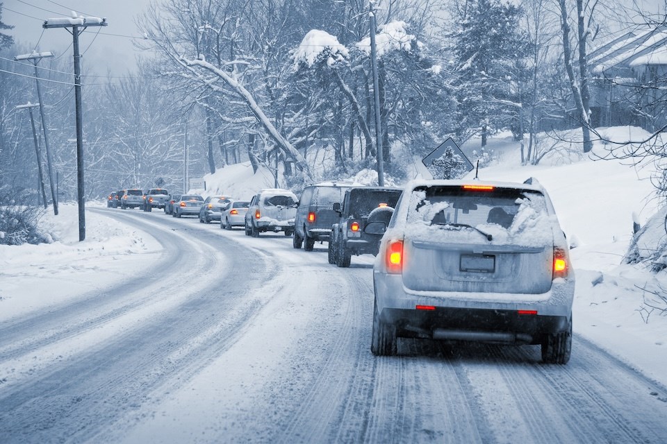
The national weather department has issued special weather statements for overnight Friday, June 20, through to Saturday due to possible wet snow over parts of B.C. highways with high elevation mountain passes.
The Okanagan Connector from Merritt to Kelowna, the Coquihalla Highway from Hope to Merritt, Hope to Princeton via Allison Pass, and Paulson Summit to Kootenay Pass may see snowfall accumulations up to four centimetres.
A disturbance in the upper atmosphere has settled over a significant portion of Western Canada, bringing widespread precipitation. In the Lower Mainland, up to 20 millimetres of rainfall is expected through Friday night and Saturday, said Lang.
The Metro Vancouver weather forecast also includes thunderstorms on Friday and gusty winds on Saturday.
Snow levels may temporarily lower to elevations between 1,200 and 1,600 metres as "intense bands of precipitation move through."
Snowfall accumulations will vary depending on elevation, according to the advisory.
Drivers should prepare for "hazardous driving conditions" as the weather in the mountains may change unexpectedly.
Stay up-to-date with hyperlocal weather forecasts across 50 neighbourhoods in the Lower Mainland with Weatherhood.


