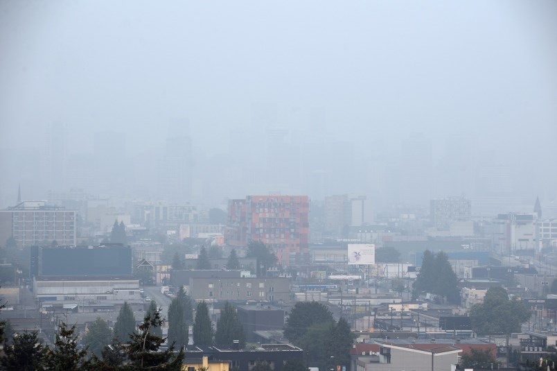
Metro Vancouver is due to see the results of B.C.’s 264 active wildfires once more as smoke is forecasted to grey out the sky before the weekend.
FireSmoke Canada, using data gathered by the Weather Forecast Research team at the University of British Columbia, provides constantly updating maps showing the movements of smoke across the province. FireSmoke Canada’s forecast shows that by 1 p.m. on Friday, Aug. 13, Metro Vancouver will see the highest concentration of particulate matter at 120 PM 2.5 (particulate matter smaller than 2.5 micrometres).
In the hours following, particulate concentration dips down to the 10-60 range. Even still, smoky air makes it harder for a person’s lungs to absorb oxygen; fine particulate matter can travel deep into the lungs and lead to inflammation and irritation. That’s particularly concerning for people with chronic lung illnesses like asthma and chronic obstructive pulmonary disease (COPD).
How to protect yourself and others
Poor air quality also poses elevated risks to anyone with heart disease or diabetes, as well as pregnant people, infants and children or older adults.
“Exposure to wildfire smoke and the virus that causes COVID-19 can result in both respiratory symptoms, such as a dry cough, sore throat, or difficulty breathing,” warns a press release from Emergency Management BC (EMBC)
EMBC recommends reducing your risk by:
- spending less time outside
- reducing outdoor physical activity
- keeping windows and doors closed
- buying a high-efficiency particulate air (HEPA) filtration system
- seeking respite in an air-conditioned vehicle or in public facilities like shopping malls, community centres, swimming pools or libraries
- If you find yourself outside, masks also offer some protection from the smoke.
Temperatures up to 38C
The smoke comes just as Environment Canada recently issued a series of hot weather warnings lasting until Sunday in the Lower Mainland, Sunshine Coast, eastern Vancouver Island, inland sections of the central and north coasts and parts of the Interior.
The weather agency says a strong ridge of high pressure is expected to reach maximum strength and bring very hot temperatures on Thursday and Friday.
It's forecasting daytime temperatures in the mid- to high 30s in the Fraser Canyon, an area that's been hard hit by wildfires, while Metro Vancouver and the Fraser Valley could see highs ranging from 34 to 38 C. It calculates the humidex could make temperatures feel more like the low 40s in those areas.
With files from Stefan Labbé and The Canadian Press


