British Columbians will see a reprieve from the bitter cold for the forecastable future, according to a new report.
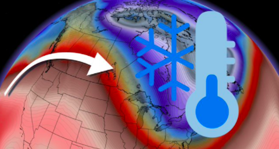
The Weather Network says the polar vortex that enveloped Western Canada in unseasonably frigid temperatures has moved to the other side of the country.
Released Sunday (Jan. 9), the report outlines how B.C. and Alberta will finally break free from the near-record low temperatures seen at the end of December and into January.
"The result will see the East take on frigid Arctic air as a polar vortex moves into the region, while Western Canada gets a welcome warm-up," reads the report.
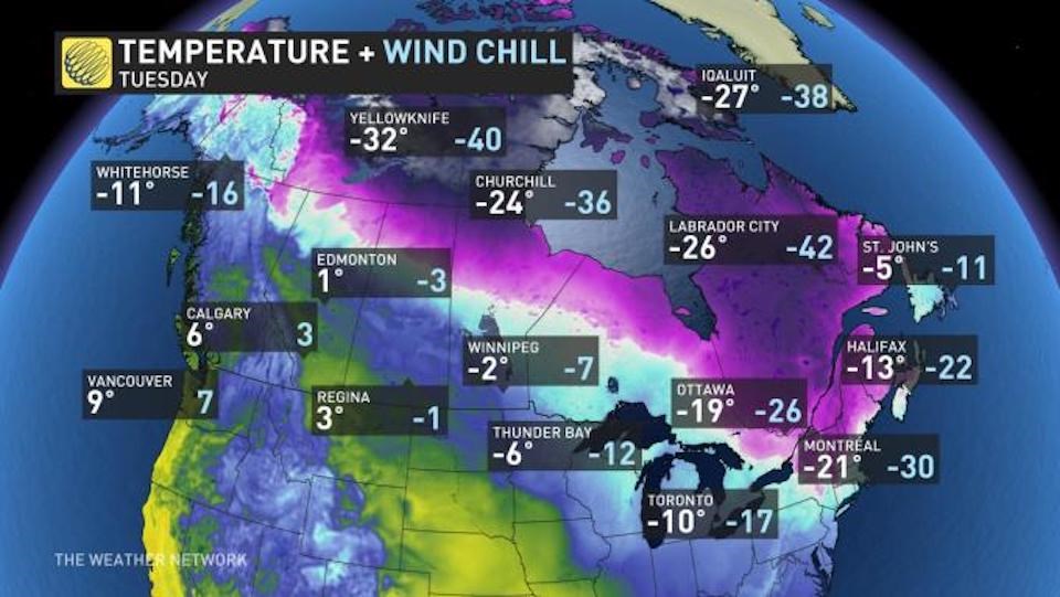
The Weather Network meteorologists state that the arctic air will migrate to Eastern Canada this week, bringing extreme cold to the region. On Monday night, for example, temperatures are expected to dip into the -20s in parts of eastern Ontario.
In contrast, the upper atmospheric pattern has broken down on the west coast, which has allowed freezing levels to rise. Instead of low-elevation snow, there will be periods of rainfall in much of the province.
The Weather Network notes that La Niña winters are typically colder and wetter.
As for Canada's eastern/western weather split? Meteorologists characterize the weather pattern reversal as a "complete switcheroo."
Metro Vancouver weather forecast includes for risk of flooding
Tyler Hamilton, a meteorologist with The Weather Network, highlights that B.C. can't seem to "catch a break" as the province braces for another heavy precipitation event.
"Flooding with significant snowmelt and heavy rain, road closures; mudslides in our future once again with a stalling atmospheric river this week," he tweeted Sunday morning.
While January is typically a wet month in Metro Vancouver, The Weather Network emphasizes that "just this week alone could bring about 100 mm of rain to the region."
"The B.C. River Forecast Centre has also issued a high streamflow advisory and says areas that experienced flooding in November may be more vulnerable for flooding, due to erosion and higher baseflow conditions."
The rain is expected to continue through the week with a third system moving into the region Tuesday night and continuing through Thursday.


