While a chilly forecast will have weather-weary Vancouverites chattering as usual, an incoming cold snap is nothing but good news for the local mountains.
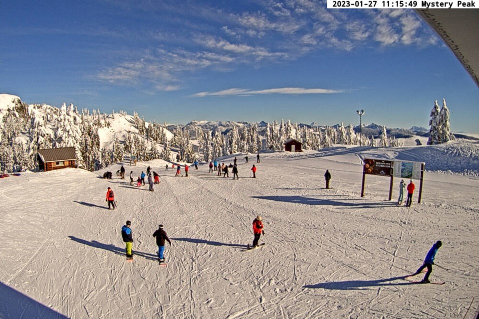
This weekend is going to be bluebird, said Simon Whitehead, marketing manager for Mt Seymour.
“We’ve got lots of new snow. And we’re going to have nice cool temperatures, and lots of sunshine,” he said. “Perfect.”
This week, Environment Canada issued a special weather statement, advising that arctic air would start to invade a large portion of B.C. beginning overnight on Friday bringing a major temperature shift. Temperatures are expected to drop drastically, dipping as low as 10 C below normal for this time of year, with additional wind chill.
On the mountains, daytime temperatures will range from -2 to -4 C this weekend, dropping to -6 C at night, according to snow-forecast.com. Wind chill could make it feel as cold as -10 C at night, so make sure to dress appropriately.
But the incoming system is forecast to bring clear skies all weekend.
“If you’re gonna work from home – in inverted commas – this Friday. I would be coming up skiing. It looks fantastic today,” Whitehead said.
Looking ahead later into next week, continuing cold weather and precipitation could bring more snow.
“It looks like we got a big storm coming in delivering lots of fresh snow,” Whitehead continued, adding that predicting weather more than three days in advance means little on the North Shore.
Seymour is reporting 38 centimetres of new snow over the past seven days, with 158 cm at base and 263 cm at summit. Grouse Mountain is reporting 15 cm of new snow, with a 181-centimetre base at plateau and 248 cm at peak. Cypress Mountain Resort is reporting 21 cm of new snow, with a 230-centimetre base mid-mountain.
For events, Cypress is hosting the Vancouver Freestyle Club Park Jam, Saturday and Sunday, 10 a.m. to 3:30 p.m. at Gnarly’s Den Terrain Park. And Grouse skiers and boarders of all levels are welcome at Grouse 3 to 6 p.m. on Saturday in Side Cut Park for Jam Over the City.
What does the forecast mean for backcountry goers?
Currently, the avalanche risk is low, and will remain that way for now, explains North Shore Rescue volunteer AJ Maheu.
But that could change.
As this cold weather comes in, the surface layer will weaken and probably create a poor bond with future snow. "That's not a certainty – it depends what the next storm brings. If the next storm starts off warm and has some rain mixed in, that will probably take care of the problem," Maheu said. "However, if the next storm is cold and we just bury that weak surface with a bunch of fresh snow, then that could become a problem."
For anyone taking the risk of venturing into off-piste terrain, Maheu said to keep a good eye on the surface that the incoming weather is going to create.
Check out Cypress's live Eagle Chair Cam


