The BC Wildfire Service's top official did not mince words during Thursday's press conference: “This weather event has the potential to be most challenging 24 to 48 hours of the summer from a fire perspective. We are expecting significant growth and we are expecting our resources to be challenged from north to south.”
The forecast in B.C. is calling for a potential “perfect storm” for wildfires over the next couple of days, with expected dry lightning and strong, erratic winds, on top of the already bone-dry conditions across much of the province.
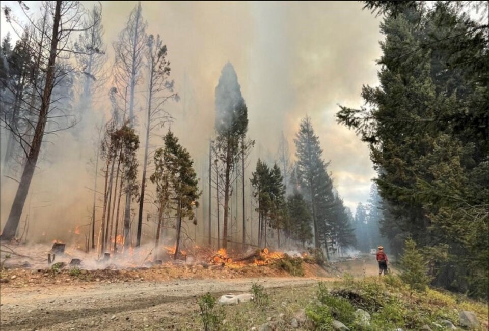
BC Wildfire Service director Cliff Chapman said this weather event is unique in that it will have a province-wide impact. But he noted the southern half of the province, including the Cariboo, Kamloops and Southeast fire centres, will be most susceptible.
“The conditions out in the forests are very primed to see significant fire growth and to see new fires challenge our suppression efforts,” Chapman said.
After a high pressure system has sat over much of the province for the past several days, driving temperatures up to the high 30s, a cold front will make its way down through B.C. from the northwest throughout the day Thursday. While the cold front will cool down temperatures to the high 20s, the transition is expected to bring strong, erratic winds, gusting to speeds of 70 km/h, along with dry lightning.
“We will see erratic winds through this event as it sweeps through the province, meaning that the wind direction will change and what used to be a flank or the face of the fire, will become the head of the fire, challenging all of the efforts that we've put in over the course of the last number of weeks,” Chapman said.
“We are expecting to see growth on [existing fires] in the next 24 hours, including through the entire evening tonight through Friday morning.
“We are anticipating a significant number of new fires across the province of B.C. ... those fires will challenge even our air tanker and helicopter resources and our ground resources.”
This cold front is expected to come through the Thompson-Okanagan region by early Thursday evening, but Chapman noted they've already seen an uptick in fire behaviour in the South and Central Okanagan.
Locally, this coming weather system will impact the McDougall Creek fire, burning in the hills above West Kelowna. That fire has already grown to an estimated 300 hectares in size, putting close to 5,000 homes on evacuation alert.
The fire could grow significantly as the winds pick up over the next couple days, and Chapman noted they have already seen aggressive fire behaviour on that fire early Thursday morning.
Chapman urged those who may face an evacuation order in the coming days to abide by the orders.
“If ever there was a time to make sure you have an evacuation plan for your house and family, it's now,” Chapman said. “I want to stress, now is not the time to not adhere to evacuation orders and alerts. The weather is going to be erratic and significant.”
Chapman agreed with Minister of Forests Bruce Ralston, calling this year one of, if not the most difficult fire seasons the province has ever seen. Chapman said this year has already broken the record for most hectares burned, and he noted the next 48 hours could see the record for most fire starts broken as well.


