The snow’s not over.
Not by a longshot.
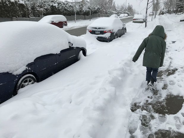
Just as British Columbia's south coast digs out from a nasty winter storm that dumped more than a half-metre of snow in some areas, another snowfall warning has been issued for the region.
Environment Canada says five to 10 centimetres of snow is expected between late Thursday and early Friday over Metro Vancouver, Greater Victoria, eastern Vancouver Island, the Gulf Islands, Sunshine Coast and Fraser Valley.
Heaviest snowfall is expected during the homeward rush but the weather office says milder temperatures mean the snow could change to rain overnight, depending on location and elevation.
The warning comes as public school students who have been out of school since Monday in many districts, including Greater Victoria, prepare to head back to class.
In the Howe Sound, Whistler and central coast regions, powerful winds are the problem, with the weather office warning of gusts between 90 and 110 kilometres per hour.
An arctic outflow warning also remains posted for the Whistler and Sea-to-Sky areas shivering through windchill values of -20, although forecasters expect conditions will ease later in the day as temperatures and winds moderate.
- With files from the Canadian Press


